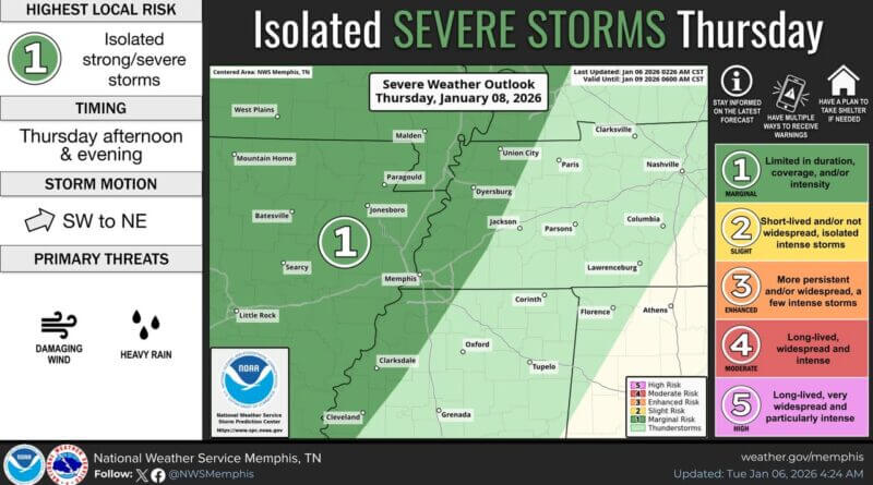
Local Source reports that a warm and humid air mass will develop over Tippah County and the broader Midsouth region late this week. This change is expected to bring a higher chance of thunderstorms starting Thursday, as an upper-level disturbance moves through the Ozarks. While most storms will remain to the west, a few could reach the Mississippi River late Thursday, potentially affecting Tippah County.
By Friday, the jetstream will shift further east, steering the storm track deeper into the Midsouth. There is still some uncertainty regarding the timing and coverage of these storms, but early indications suggest that areas east of the Mississippi River and south of I-40, including Tippah County, will have the greatest chance of experiencing storms, likely during Friday afternoon and evening.
Authorities warn that damaging winds are expected to be the primary severe weather threat on both days, which could impact local communities and infrastructure. Residents are advised to stay updated on weather alerts as the week progresses.
Additional details were not immediately available.
Jon Ross Myers is the executive editor and publisher of the Mississippi News Network, Mississippi's largest digital only media company. He can be reached at editor@tippahnews.com