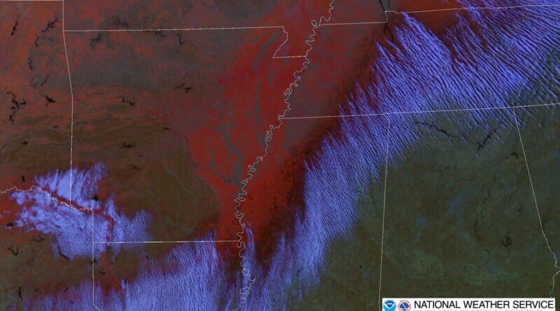
Satellite image shows snow, ice, and cloud formations over Mississippi and Alabama
A satellite image taken at 21:21 UTC (3:21 p.m. CST) shows snow, ice, and cloud formations over northeast Mississippi and northwest Alabama. The image is from the GOES Day Snow-Fog satellite imagery system.
Colors in the image indicate different weather features: dark red represents ice, while light red to orange shows snow. The image also captures convective cloud rolls, known as “cloud streets,” which form as cold air moves off the ice pack onto warmer ground, according to sources.
More information about GOES Day-Fog imagery can be found at the Colorado State University website. Details about cloud streets are available from NOAA’s Physical Science Laboratory.
Source: Original Article


