A strong Tippah County cold front is set to arrive Friday, Oct. 16, ending a stretch of near-record October heat and bringing the first truly fall-like weekend of the season to Ripley, Walnut, Blue Mountain, Falkner and neighboring Benton County. The National Weather Service in Memphis says highs in the low 90s will hold through Thursday before temperatures drop sharply, with weekend highs in the upper 60s and lows in the 40s.
Heat Holds Through Thursday
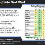
The NWS point forecast for Ripley issued Monday morning calls for sunny skies and highs near 90 on Monday, near 91 on Tuesday, and near 92 on both Wednesday and Thursday. Overnight lows will stay in the low 60s.
In its Monday forecast discussion, the Memphis office said the region will be “flirting with potential record breaking warmth through at least Thursday” as a ridge of high pressure sits over the Lower Mississippi Valley. Southerly winds will also pull Gulf moisture into the area starting late Monday, so the heat will feel more humid than last week’s dry warmth.
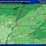
Forecasters expect scattered showers and storms Wednesday, mainly north of the Interstate 40 corridor in Tennessee. Little or no rain is expected in Tippah and Benton counties, and no severe weather is anticipated.
Tippah County Cold Front Brings a Sharp Drop
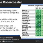
Forecasters say a pattern change begins late Thursday into early Friday as an upper-level trough digs into the Midwest and a cold front pushes across the Mid-South. The air behind the front looks “almost polar in nature,” according to the NWS discussion.
The current Ripley forecast shows:
Friday: Sunny, high near 78; low around 46 Friday night
Saturday: Sunny, high near 69; low around 43 Saturday night
Sunday: Sunny, high near 74; low around 47 Sunday night
The NWS noted that some parts of the Mid-South could see lows in the upper 30s to lower 40s by Sunday morning, though forecasters said uncertainty remains in the details. Residents may want to have jackets ready for Saturday morning activities and bring in tender plants if lows trend colder.
Drought and Burn Ban Still a Concern
The cooler air will not bring much relief from the dry conditions. The U.S. Drought Monitor map released Oct. 8 shows all of Tippah County in at least moderate drought (D1), with about 46% of the county in severe drought (D2). In Benton County, about 56% of the land is in severe drought.
The NWS said humidity could fall to around 30% or lower Monday, though light winds should keep fire danger low. Dry, breezy conditions behind cold fronts can raise the fire risk, so residents should keep following local burning rules.
Tippah County’s burn ban for unincorporated areas remains in place. The Southern Sentinel reported that supervisors set the ban to run through Oct. 18 and will decide on any extension at their Oct. 15 meeting. Hardeman County, Tenn., residents near Middleton should note that Tennessee requires burn permits starting Oct. 15.
What to Watch This Week
Limit strenuous outdoor work during afternoon heat Monday through Thursday, and drink plenty of water.
Check pets and livestock for shade and water during the hot days.
Watch for updated forecasts on exact weekend low temperatures.
Do not burn outdoors while the county burn ban is in effect.
Forecasts can change, so check the National Weather Service in Memphis for the latest updates for Tippah County.
Jon Ross Myers is the executive editor and publisher of the Mississippi News Network, Mississippi's largest digital only media company. He can be reached at editor@tippahnews.com