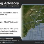
Tippah County residents should expect frost early Sunday morning, and more may form Monday, according to the National Weather Service in Memphis. The forecast for Ripley calls for patchy frost after 3 a.m. tonight (Saturday, Nov. 7) with a low around 35. Areas of frost could linger until about 8 a.m. Sunday.
High pressure is settling over the Mid-South, and in its Saturday morning forecast discussion the weather service said calm winds and clear skies will allow “ample radiational cooling” overnight. That is the setup that lets frost form on grass, rooftops and windshields even when the official low stays a few degrees above freezing.
Tippah County frost forecast by town
Point forecasts from the National Weather Service for the coverage area show similar conditions tonight:
Ripley: Patchy frost after 3 a.m., partly cloudy, low around 35. Sunday is sunny with a high near 63.
Ashland (Benton County): Patchy frost and patchy fog after 2 a.m., low around 35.
Middleton, Tenn.: Fog developing this evening, then frost and fog overnight, mostly clear, low around 33.
Forecasters said the best chance of freezing temperatures tonight is north of the Mississippi-Tennessee line, especially across much of West Tennessee, where models give a 40% to 60% chance of temperatures at or below 32 degrees. They said freezing fog “cannot be ruled out” in those areas and urged early commuters to be careful on the roads. Fog is expected to clear by mid-morning.
Fog and frost again Monday
The pattern repeats Sunday night. Ripley’s forecast calls for areas of fog after 9 p.m. Sunday and a low around 36, then areas of fog and patchy frost before 8 a.m. Monday. Monday afternoon turns much warmer, with a high near 71.
Sunrise in Ripley on Sunday is at 6:23 a.m. and sunset is at 4:56 p.m., according to the U.S. Naval Observatory. Drivers heading out before sunrise should allow extra time to clear frosted windshields and slow down in patchy fog.
Veterans Day week outlook
The weather service expects a mild stretch in the middle of the week:
Tuesday: Morning fog, then mostly sunny with a high near 70.
Veterans Day (Wednesday): Mostly sunny, high near 70. A slight (20%) chance of showers and thunderstorms Wednesday night.
Thursday: Mostly sunny, high near 61, after a cold front moves through.
Friday: Sunny and colder, high near 55, with a low around 31 Friday night.
The Wednesday forecast looks good for Ripley’s Veterans Day program, which is set for 11 a.m. at the Smith Sportsplex. Forecasters noted that the late-week front is the area’s best chance of rain over the next seven days, but rainfall totals are not expected to be significant.
Cold-weather reminders
Cover or bring in tender potted plants tonight and Sunday night.
Bring pets indoors or give them shelter and unfrozen water, especially ahead of Friday night’s colder low.
Check the Mississippi Forestry Commission’s burn ban list before any outdoor burning, since dry, sunny days can raise fire danger.
Watch for slick spots on bridges and overpasses where frost or freezing fog forms first.
Jon Ross Myers is the executive editor and publisher of the Mississippi News Network, Mississippi's largest digital only media company. He can be reached at editor@tippahnews.com