Weekend risk for large, strong tornadoes in Mississippi increased
The National Weather Service risk for large, strong tornadoes in Missisippi this weekend has been incrEased. The NOAA storm prediction center issued the enhanced risk on Sunday.
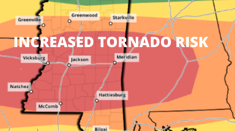
From Mississippi Weather Network:
UPGRADED TO RARE MODERATE RISK: Central and South MS have once again been upgraded to a “rare” moderate (level 4/5) risk from the NOAA NWS Storm Prediction Center. The threat FOR LARGE, STRONG TORNADOES HAS BEEN SIGNIFICANTLY INCREASED based on the newest model runs this afternoon.
There area also other modes of severe weather possible such as damaging straight-line winds, large hail, and major flooding in some areas. The location of the most concern will be south and along of Highway 16 and north of the MS Gulf Coast counties.
Right now the timing is still a little hard to track down completely, but it looks like our tornado threat will be ramping up significantly around midday to early afternoon. All of us at Mississippi Weather Network are working hard to bring you the latest severe weather expectations and will of course have live breaking coverage when storms turn severe.
We will have a copy of the MWN live feed tomorrow should the situation turn especially dangerous.


