Tropical Storm Arthur threatens Gulf Coast with dangerous flash flooding
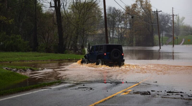
Tropical Storm Arthur formed Wednesday over the Gulf of Mexico and is expected to bring dangerous, life-threatening flash flooding from Texas to the Florida Panhandle, the National Hurricane Center said.
The NHC said Arthur was a disorganized, short-lived system with maximum sustained winds near 45 mph (75 kph). A tropical storm warning remained in effect for about a 350-mile (560-kilometer) stretch of the Texas and Louisiana coast, the center said.
National Hurricane Center director Michael Brennan said flash flood warnings were already being issued in the Houston area and that more were likely across the region even after the storm’s center passes. “The main threat from Arthur is going to be a prolonged, multiday, heavy rainfall event that could produce dangerous to life threatening flash flooding,” he said during a briefing.
The Montgomery County Sheriff’s Office said a 15-year-old boy drowned in a flooded retention pond outside Houston after entering the water near a construction zone. The office said rescue workers found his body using sonar following an extensive search and added, “This incident serves as a solemn reminder of the dangers associated with floodwaters, particularly following periods of heavy rainfall.”
The NHC said Arthur was centered about 55 miles (90 kilometers) northeast of Port O’Connor, Texas, and was moving northeast near 9 mph (15 kph). Forecasters expected the storm to produce 5 to 10 inches (13 to 25 centimeters) of rain, with isolated totals near 20 inches (50 centimeters). The center warned that storm surge combined with high tide could flood normally dry coastal areas, while swells could cause life-threatening surf and rip currents and tornadoes remained possible through Thursday.
Source: Original Article


