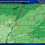
Help may finally be on the way for Tippah and Benton counties after a hot, bone-dry September. The Tippah County rain forecast from the National Weather Service in Memphis calls for showers and thunderstorms Friday through early Sunday, with forecasters expecting rainfall totals of 1 to 1.5 inches or more across much of north Mississippi. First, though, the area has two more days of summer-like heat ahead.
Tippah County Rain Timeline: Friday Through Early Sunday
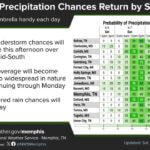
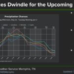
In its Wednesday morning forecast discussion, the NWS said an upper-level low now over the Southwest will lift into the Plains and weaken as it moves toward the Mid-South. A weak cold front will slide across the region at the same time. Moisture levels are expected to climb near record territory for this time of year, with precipitable water values approaching 2 inches this weekend.
The point forecast for Ripley lays out the timeline:
Wednesday and Thursday: Sunny to mostly sunny, with highs near 91 degrees and south-southeast winds of 5 to 15 mph.
Thursday night: A 30 percent chance of showers after 1 a.m., with a low around 70.
Friday: Showers and thunderstorms likely (70 percent chance), with a quarter to half an inch of rain possible during the day. Highs in the upper 80s, falling into the mid-80s in the afternoon.
Friday night and Saturday: More showers and storms likely, with another quarter to half an inch possible Friday night and a much cooler Saturday high near 79.
Saturday night: Rain chances remain around 70 percent, with a low near 64.
Forecasters said severe weather is not expected because instability and wind shear look limited. Behind the front, cooler and drier air should settle in early next week, with highs in the 70s to around 80 and lows mostly in the 50s.
Why the Rain Matters for Tippah and Benton Counties
The rain can’t come soon enough. The U.S. Drought Monitor map released last week showed all of Tippah County in at least moderate drought (D1), with severe drought (D2) covering about 45 percent of the county. A week earlier, the county had no severe drought at all. In Benton County, the whole county was in moderate drought and about 15 percent was in severe drought.
The dry spell has brought burn bans in both counties and a string of grass and woods fires across the region. The NWS fire weather outlook said humidity should improve Wednesday and Thursday before “wetting rainfall” arrives Friday. Even so, a single rain event won’t cancel a county burn ban on its own. Residents should check the Mississippi Forestry Commission burn ban list or with county officials before doing any outdoor burning.
Weekend Plans: What to Watch
The wet timing lines up with a busy weekend. Friday night high school football, the Ripley First Monday Trade Day’s October market on Oct. 3-4 and other outdoor events could all see rain. Here are a few tips:
Check the latest NWS Memphis forecast before heading out Friday evening and Saturday.
Watch for slick roads when the first rain falls, since oil builds up on pavement after long dry stretches.
Follow schools, event organizers and local government pages for any schedule changes.
Tippah News will post updates if the forecast changes or if any watches or warnings are issued for Tippah, Benton or Hardeman counties.
Jon Ross Myers is the executive editor and publisher of the Mississippi News Network, Mississippi's largest digital only media company. He can be reached at editor@tippahnews.com