Severe weather alerts: extreme heat advisory, storms possible
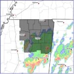
The national weather service has issued an extreme heat advisory for north Mississippi. We are also tracking several storm systems that might develop
From the NWS:
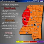
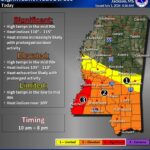
HEAT ADVISORY IN EFFECT FROM 10 AM THIS MORNING TO 9 PM CDT THIS EVENING…
The National Weather Service in Memphis has issued a Heat Advisory, which is in effect from 10 AM this morning to 9 PM CDT this evening.
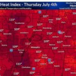
* HEAT INDEX READINGS…105-109F
* TIMING…from 10am CDT this morning to 9pm CDT this evening.
* IMPACTS…the combination of hot temperatures and high humidity will likely lead to an increased risk of heat related stress and illness. The very young, the elderly, those without air conditioning, and those participating in strenuous outdoor activities will be the most susceptible. Also, car interiors can reach lethal temperatures in matter of minutes.
PRECAUTIONARY/PREPAREDNESS ACTIONS…
A Heat Advisory means that a period of hot temperatures is expected. The combination of hot temperatures and high humidity will combine to create a situation in which heat illnesses are possible. Drink plenty of fluids, stay in an air-conditioned room, stay out of the sun, and check up on relatives and neighbors.
Take extra precautions, if you work or spend time outside. When possible, reschedule strenuous activities to early morning or evening. Know the signs and symptoms of heat exhaustion and heat stroke. Wear light weight and loose fitting clothing whenpossible and drink plenty of water.
To reduce risk during outdoor work, the occupational safety and health administration recommends scheduling frequent rest breaks in shaded or air conditioned environments. Anyone overcomeby heat should be moved to a cool and shaded location. Heat stroke is an emergency, call 9 1 1.

