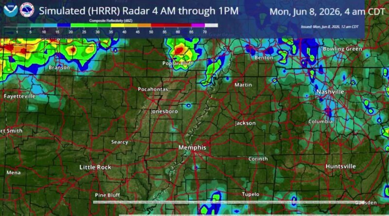
The High-Resolution Rapid Refresh model’s simulated radar shows potential storms developing over northeast Oklahoma and southeast Kansas that could move into east Arkansas and toward the Mississippi River from 4 a.m. to 1 p.m., according to the HRRR model.
The model indicates the system originates over northeast Oklahoma and southeast Kansas and may track eastward into Arkansas, the simulated output shows.
The HRRR simulated radar covers the early morning through early afternoon period and outlines the timing and possible path of the storms, according to the model data.
The High-Resolution Rapid Refresh (HRRR) model provides short-term forecasts based on evolving atmospheric conditions, and its simulated radar is used to depict potential storm motion and timing, the model’s output indicates.
Jon Ross Myers is the executive editor and publisher of the Mississippi News Network, Mississippi's largest digital only media company. He can be reached at editor@tippahnews.com


 severe-weather risk with hail, damaging winds")