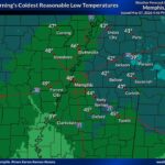
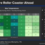
Expect Ripley frost again tonight and for the next few mornings across Tippah County, Benton County and the Middleton area. The National Weather Service in Memphis forecasts widespread frost after 1 a.m. Monday, with a low around 34 in Ripley. After that, the pattern turns quiet and sunny, and each afternoon gets a little warmer until highs reach the low 70s by Thursday.
Saturday’s hard freeze is behind us, and this week’s cold mornings will not be as harsh. Most nights stay a couple of degrees above freezing in town. Low-lying fields, creek bottoms and rural yards will still frost over, and the Middleton area could drop to 30.
Ripley Frost Timeline for the Week
Here is how the NWS Memphis point forecasts for Ripley, Ashland and Middleton looked Sunday evening:
Tonight (Sunday night): Widespread frost after 1 a.m. under mostly clear skies. Lows near 34 in Ripley, 33 in Ashland and 30 in Middleton. Light northeast wind.
Monday: Widespread frost before 8 a.m., then sunny. Highs near 62 in Ripley and 61 in Ashland and Middleton.
Monday night: Clear, with frost developing after 2 a.m. Lows near 34 in Ripley, 33 in Ashland and 30 in Middleton.
Tuesday: Frost early, then sunny. Highs in the mid 60s.
Tuesday night: Clear, with patchy frost possible toward daybreak. Lows in the mid to upper 30s. Patchy fog is possible around Middleton.
Wednesday: Patchy frost before 7 a.m., then sunny. Highs in the upper 60s.
Thursday: Mostly sunny, with a high near 71 in Ripley. Thursday night lows are expected around 42.
No rain is in the Ripley forecast through Thursday night.
What the Frost Means at Home
Frost forms when clear skies and calm winds let ground-level temperatures fall below the official air temperature, which is measured about six feet up. Even when the forecast low is 34, grass, rooftops and windshields can still ice over. A few simple steps help:
Plants: Bring in potted plants or cover tender ones with a sheet or frost cloth in the evening. Take the covers off once the sun is up.
Pets and livestock: Make sure outdoor animals have shelter and water that isn’t frozen in the early morning.
Morning drives: Leave a few extra minutes to clear frosted windshields. Watch for slick spots on bridges and shaded rural roads before sunrise, especially for school bus routes and early commuters.
Heating: If you use space heaters, keep them three feet from anything that can burn and plug them straight into the wall.
Warmer, Drier Pattern Later in the Week
The warm-up comes with a dry stretch. Each sunny afternoon will be a little warmer, and by midweek light southeast winds return. If you plan any outdoor burning now that county burn restrictions have eased, check conditions first. Keep fires small and attended, and have water nearby. For the latest on burn orders, see our Tippah County burn ban update.
Forecasts can change, so check the National Weather Service before early-morning plans. Our earlier coverage of Saturday’s hard freeze in Tippah County has more cold-weather tips.
Jon Ross Myers is the executive editor and publisher of the Mississippi News Network, Mississippi's largest digital only media company. He can be reached at editor@tippahnews.com