Tippah County Flood Watch Set as Isaias Rain Nears
The National Weather Service in Memphis has placed Tippah County under a flood watch from late Friday night through Sunday morning, as the remnants of Hurricane Isaias are expected to push heavy rain north into the Mid-South. The Tippah County flood watch, issued at 12:13 p.m. Thursday, Oct. 8, also covers Benton County in Mississippi and Hardeman County in Tennessee, and runs until 7 a.m. Sunday, Oct. 11.
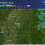
Forecasters say local rainfall totals of up to 4 inches are possible in areas east of the Mississippi River, which includes Ripley, Walnut, Blue Mountain, Falkner, Ashland, Hickory Flat and Middleton.
What the Tippah County flood watch means
A flood watch means conditions are favorable for flooding. It does not mean flooding is happening now. According to the weather service, excessive runoff could flood rivers, creeks, streams and other low-lying and flood-prone spots.
The watch covers a wide area of North Mississippi and West Tennessee, including:
- North Mississippi: Tippah, Benton, Alcorn, Union, Lafayette, Marshall, Prentiss, Tishomingo, Lee, Pontotoc, DeSoto and other counties
- West Tennessee: Hardeman, McNairy, Fayette, Chester, Hardin, Shelby, Madison and other counties
Rain timeline for Ripley and the area
The NWS point forecast for the Ripley area calls for one more hot, sunny day Friday, with a high near 88, before the pattern changes quickly:
- Friday night: A 30% chance of showers after 5 a.m., with a quarter to half an inch of rain possible.
- Saturday: Rain and thunderstorms are all but certain (100% chance), and some storms could produce heavy rain. Rainfall of 2 to 3 inches is possible. Temperatures should top out near 70, and gusts could reach 40 mph.
- Saturday night: Showers and storms continue, with another three-quarters of an inch to an inch possible and gusts up to 30 mph.
- Sunday: Showers taper off early, with partly sunny skies and a high near 75.
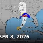
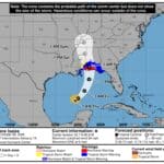
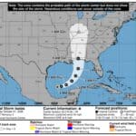
As of the National Hurricane Center’s 10 a.m. Thursday advisory, Isaias was a hurricane in the central Gulf with maximum sustained winds near 85 mph, moving east-northeast at 10 mph. The NHC said preparations on the Gulf Coast should be rushed to completion Thursday.
How to prepare
The weather service urges residents to monitor later forecasts and be ready for possible flood warnings. People who live in flood-prone areas should be prepared to act if flooding develops. A few practical steps:
- Never drive through water covering a road. It takes only a small amount of moving water to sweep a vehicle away. Turn around, don’t drown.
- Clear gutters and storm drains near your home before the rain arrives Friday night.
- Secure loose outdoor items such as patio furniture, trash carts and Halloween decorations ahead of Saturday’s gusty winds.
- Charge phones and have a way to receive weather alerts, especially overnight Saturday.
- Check plans for outdoor events and ballgames scheduled for Saturday.
The heavy rain will land on ground that has been very dry. Tippah County has been under drought conditions and a burn ban in recent weeks. Hard, dry soil can increase runoff at first, so creeks and ditches may rise quickly during heavier downpours.
Tippah News will update as the weather service issues new forecasts or warnings.
Related: Hurricane Isaias to Bring Saturday Rain, Gusts to Tippah County | Tippah County Supervisors Weigh Lazy H Shelter Partnership
Source: National Weather Service Memphis