Tropical Storm Isaias formed early Wednesday in the southwestern Gulf, and forecasters say it is likely to become a hurricane before making landfall on the central Gulf Coast late Friday. Its remnants could then move over northeast Mississippi on Saturday. For Tippah and Benton counties, that likely means gusty winds and a soaking rain this weekend, after weeks of drought and burn bans.
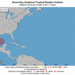
The National Hurricane Center upgraded Tropical Depression Nine to Tropical Storm Isaias in its 4 a.m. CDT advisory on Oct. 7. At that time, the storm was about 580 miles southwest of the mouth of the Mississippi River, with maximum sustained winds near 40 mph, moving east-northeast at 8 mph. The hurricane center said rapid strengthening is expected, and Isaias could reach hurricane strength by Thursday.
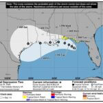
Tropical Storm Isaias forecast track and landfall
The NHC forecast shows Isaias passing north of Mexico’s Yucatan Peninsula on Thursday, then turning northeast and north toward the northern Gulf Coast. The hurricane center’s forecast has the storm peaking near 110 mph over the central Gulf early Friday, then coming ashore near the Mississippi-Alabama line late Friday night as a hurricane. The NHC said hurricane and storm surge watches will likely be needed for part of the northern Gulf Coast later Wednesday.
In its Wednesday morning forecast discussion, the National Weather Service office in Memphis said Isaias may weaken quickly after landfall. Forecasters currently expect the storm’s remnant low to track over far northeast Mississippi on Saturday afternoon, then speed up through the Tennessee River Valley Saturday evening. The weather service cautioned that there is still uncertainty about the storm’s strength at landfall and its path after that.
What to expect in Ripley this weekend
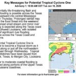
NWS Memphis said the main local impacts will likely be gusty winds and rain from early Saturday through Sunday evening. The office said winds east of the Mississippi River could reach Wind Advisory levels if the current track and intensity forecasts hold. Because the storm will be moving fast, rainfall should average 1 to 3 inches east of the river, with up to 4 inches possible near the Tennessee River.
The latest NWS point forecast for the Ripley area calls for:
Wednesday through Friday: Sunny and very warm, with highs near 87 to 89.
Friday night: Partly cloudy, low around 62, with rain possible.
Saturday: Showers in the morning, then showers and thunderstorms likely. High near 77, with east winds 5 to 20 mph and gusts up to 35 mph. Rain chance 70 percent.
Saturday night: Showers and thunderstorms likely, with gusts up to 35 mph.
Sunday: Rain showers likely, high near 76.
The hurricane center added that 1 to 3 inches of rain, with local totals up to 5 inches, is possible across much of the Southeast as far north as the Tennessee Valley. It warned that flash flooding and urban flooding could occur.
Fire danger peaks before the rain arrives
Before any rain falls, the weather service says fire danger will stay elevated, with afternoon humidity in the 25 to 35 percent range through Friday. Stronger winds ahead of the storm could push wildland fire danger to its peak on Friday. Tippah County remains under an outdoor burn ban, so residents should avoid any outdoor burning.
How to prepare
Secure trampolines, patio furniture, trash cans and other loose items before Saturday.
Clear leaves from gutters and storm drains so heavy rain can drain away.
Charge phones and keep flashlights handy in case gusty winds bring down limbs and power lines.
Never drive through water covering a road. Turn around instead.
Check the latest NHC and NWS Memphis updates, since the track could still shift.
Tippah News will keep following Isaias as new advisories come out.
Jon Ross Myers is the executive editor and publisher of the Mississippi News Network, Mississippi's largest digital only media company. He can be reached at editor@tippahnews.com